Science
Noah’s Ark in Turkey? What the new wood claim actually shows
Researchers report charred wood beneath Turkey’s Durupınar formation. Dating is pending, and geologists dispute the proposed Ark identification.
What to know
- On October 27, the project announced wood awaiting laboratory testing.
- A Turkish university confirms that authorized research is underway; its evaluation extends into 2027.
- Radar images and a ship-like outline do not independently identify a constructed vessel.
- Earlier geological examinations support a natural origin, while the current team argues for an artificial structure.
Researchers investigating Turkey’s boat-shaped Durupınar formation report charred wood from nearly 30 feet underground. The material awaits dating and identification, according to an October 27 announcement from Noah’s Ark Scans.
The report does not establish a vessel or Noah’s Ark. Turkey’s professional geological engineers’ chamber says the disclosed evidence cannot independently verify that identification. Read the chamber’s statement.
Where is the proposed Noah’s Ark site?
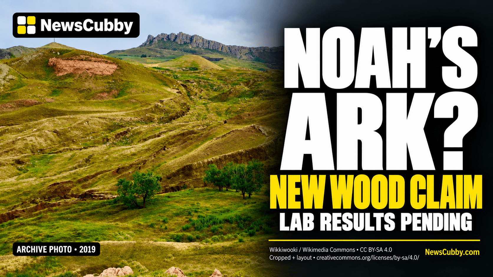
The Durupınar formation lies near Doğubayazıt in eastern Turkey, south of Mount Ararat. Its reported length is approximately 515 feet, or 157 meters. It is a landform on a hillside, not an exposed wooden ship on the mountain’s summit. Its elongated outline has attracted investigations for decades. Geologist Lorence Collins’s 2016 examination describes that history and the competing interpretations of its rocks.
The current effort is led academically by archaeologist Professor Cenker Atila of Sivas Cumhuriyet University, with support from Noah’s Ark Scans. The university’s July project announcement describes mapping, subsurface surveys and sampling involving about 20 researchers and students from five countries.
Those institutional details matter: this is an actual investigation with a stated research program. However, authorization to investigate a hypothesis is different from official authentication of the object being sought. Readers should distinguish the existence of the project from the conclusion its advocates hope to establish.
What would the reported wood tell researchers?
The organization’s announcement, distributed by GlobeNewswire, says photographs will follow. It is a project statement, not an independent laboratory report.
For interpreting any eventual result, the important distinction is between a sample’s age and its use. The Oxford Radiocarbon Accelerator Unit explains that a wood or charcoal measurement dates the growth of the sampled tree ring. It does not directly date a ship’s construction or the moment wood entered the ground. Selecting particular growth rings also affects the relationship between the measurement and the event being investigated.
Sample preparation matters, too. Radiocarbon laboratory Beta Analytic explains that roots, soil compounds and limestone can affect wood or charcoal measurements. Depending on the contaminant, the apparent age can move in either direction. That is a general laboratory issue, not evidence that these particular samples are contaminated.
An old result would therefore open further questions: Where exactly was the material recovered? What surrounded it? Does it show working or assembly? Can separate laboratories reproduce the finding? Those questions connect an identifiable piece of material to a specific archaeological claim.
Do the radar images show rooms inside a ship?
Radar specialist Khosrow Bakhtar interprets the survey as evidence of an artificial structure. In the project’s October 1 statement, he argues that processing masked geological features, leaving organized patterns he identifies as passageways and compartments. That is the team’s interpretation, rather than an independently established identification.
Ground-penetrating radar is useful precisely because it can detect differences below the surface. The U.S. Environmental Protection Agency’s explanation describes pulses that reflect at boundaries between materials with different electromagnetic properties. Water content can strongly influence those properties. The resulting picture represents measured signals and their interpretation, rather than an underground camera photograph.
The method can help locate an object or map geological structure. Its usefulness does not eliminate the need to determine what produced a particular response. A strong line can identify a boundary worth testing without identifying its material or the process that made it.
There is also a trade-off between depth and detail. The EPA’s CLU-IN technical guide explains that higher-frequency antennas can distinguish smaller features but penetrate less deeply, while lower frequencies reach farther with less resolution. Site conditions affect performance as well. This makes the instrument settings and survey conditions relevant to evaluating any dramatic image. A clean-looking graphic is not a substitute for knowing the scale of features the measurement could actually distinguish. Independent reviewers need those methodological details alongside the resulting visualization.
That distinction is especially important when a graphic labels a feature a room or corridor. The label is a proposed explanation. Sampling at the corresponding location is a way to test it; repeating the label does not add a second piece of evidence.
What has the drilling established?
The team’s September drilling announcement reported organic-rich material, cavities and an unidentified resistant layer that broke a drill bit. It also reported no continuous bedrock in the interior holes completed at that point. The team sees those observations as a challenge to natural-rock explanations.
The material encountered at each depth still needs identification. A drill’s mechanical failure is an observation about an operation; it is not, by itself, a mineralogical diagnosis of petrified timber. Similarly, the absence of a particular rock boundary in a hole has to be evaluated against the exact geological model and location being tested.
Atila acknowledged uncertainty during a Jerusalem Post site visit published October 22. Jones told the newspaper that the team drilled 12 holes inside the formation and four outside, reaching about 20 meters, or 66 feet, in some locations. Discussing a possible corridor, Atila allowed that it might instead be a geological cavity. His caution is significant because he directs the university research. The outlet’s visit documents access to the project, not independent authentication of an Ark.
Could soil chemistry indicate buried timber?
In an October 20 critique, Nate Loper in Answers Research Journal examines reported differences between soil inside and outside the outline. He argues that vegetation, drainage and soil accumulation must be controlled before those differences can be attributed to a buried structure. The journal operates within a creationist framework; this is a criticism from within a community that takes the biblical account seriously.
Ordinary plant activity can contribute organic material and nutrients to soil. The U.S. Department of Agriculture’s soil guidance describes how vegetation residues, water movement and soil management change organic matter. It does not assess Durupınar, but it helps explain why a chemical difference needs a site-specific explanation.
The scientific value lies in comparing plausible causes. If comparable natural ground produces the same pattern, the chemistry becomes less distinctive. If careful controls leave a difference unexplained, it becomes a stronger target for further work. Neither outcome should be assumed before the comparison is made.
Why do geologists favor a natural explanation?
Collins reported that earlier samples presented as petrified wood were volcanic rock under microscopic examination. Those findings concern the material he studied, not the newly announced samples awaiting tests.
There is also a historical nuance. A 1996 paper coauthored by Collins and David Fasold proposed a folded-rock interpretation. In a later postscript, Collins withdrew that particular model while maintaining a natural explanation involving landslide and erosion processes. Revising the mechanism did not mean endorsing the Ark claim.
The chamber favors evaluation through landslides, erosion and rock differences, while acknowledging that detailed field evidence is needed to reconstruct the formation’s full development.
What do the photographs actually show?
The project’s own gallery includes ordinary site photographs, radar visualizations and combined overlays. One display explicitly places 2019 survey results over a 2020 drone photograph. Such an image can illustrate a hypothesis, but it does not show excavated walls or exposed wooden decks.
Archive dates are consequential here. A photograph circulating alongside a new report may show the same hillside years earlier. It can accurately establish the site’s appearance without documenting this season’s sampling or a newly recovered object. A reconstruction and a documentary photograph answer different questions, even when presented together.
Fox News also covered the investigation.
What happens next?
The university’s September 28 update places comprehensive evaluation and reporting into mid-2027. That is a research timetable, not a promised confirmation date.
The next useful evidence would connect laboratory results to documented locations and independently testable subsurface features. An ancient sample, a constructed vessel and Noah’s Ark are three increasingly specific propositions. Establishing the first would not automatically establish the other two. The investigation now offers opportunities to test those connections; its public interpretation should move only as far as the results support.
For more on interpreting research milestones, read NewsCubby’s explanations of NASA’s lunar-battery tests and planned blood-vessel bioprinting in space, or browse our science coverage.
*Want more? Explore today’s headlines on NewsCubby and join My Day free to make NewsCubby part of your day.*
*ARCHIVE PHOTO: The Durupınar formation in eastern Turkey, July 8, 2019; not this season’s fieldwork or a photograph of recovered wood. Photo: Wikkiwooki / Wikimedia Commons / CC BY-SA 4.0. Thumbnail cropped with text and layout added; adaptation shared under the same license. Original photograph.*
*NewsCubby articles are produced with AI assistance and reviewed by humans.*
Sources, credits & editorial notes
- Noah’s Ark Scans: October 27 wood announcement (project press release)
- Turkey’s Chamber of Geological Engineers: October 21 statement
- Lorence Collins: Noah’s Ark near Dogubayazit, Turkey? (2016)
- Sivas Cumhuriyet University: July 28 research program announcement
- Oxford Radiocarbon Accelerator Unit: dating methods and sample interpretation
- Beta Analytic: contamination in charcoal and wood samples
- Noah’s Ark Scans: October 1 radar interpretation (project press release)
- U.S. EPA: how ground-penetrating radar works
- U.S. EPA CLU-IN: radar frequency, penetration, resolution and site conditions
- Noah’s Ark Scans: September 23 drilling announcement (project press release)
- Jerusalem Post: October 22 site visit and interviews
- Nate Loper / Answers Research Journal: October 20 critique
- USDA NRCS: the role of soil organic matter
- Collins and Fasold: 1996 geological paper, including author’s later postscript
- Noah’s Ark Scans: project gallery, captions and image dates
- Fox News: October 2 investigation coverage
- Sivas Cumhuriyet University: September 28 status and reporting timetable
- Photo: Wikkiwooki / Wikimedia Commons, CC BY-SA 4.0 (archive; cropped/layout)